4 March 2014 Jerrabattgulla Creek, Southern Tributaries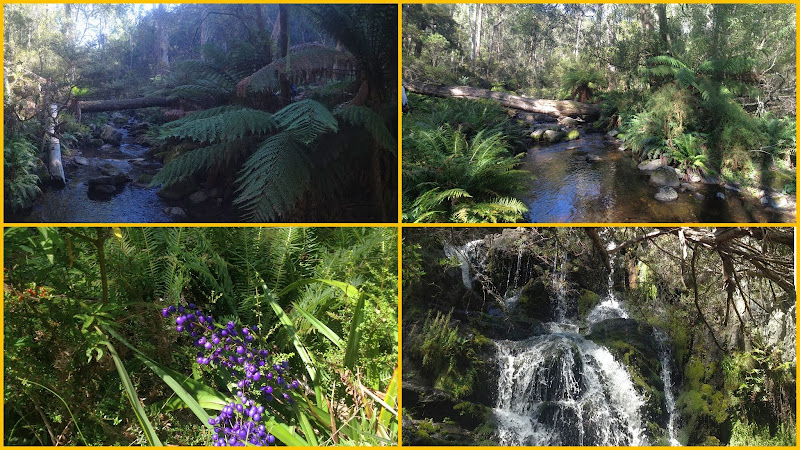 Jerrabattgulla Creek | Walking the tributary to Jerrbattgulla Creek | Purple Flax Lily (Dianella revoluta) | Small waterfall Maps: Jerangle, Krawarree 1:25,000 & South Coast Forest Map 1:150,000 Walk Description This walk was organised and led by Ian W as an irregular CBC Tuesday walk: Tuesday 4 March: Jerrabattgulla Creek, Southern Tributaries - M/R,WptX. The walk is in a Preserved Forest area in the Tallaganda State Forest, east of Jerangle. We will revisit the southern Jerrabattgulla Creek system where I led a walk on 5/3/2013. The going was slow on that trip so we didnt have time to explore one of the bigger tributaries. I also plan to have another look at the waterfall that we found, this time from below. Start on the Jerrabattgulla Forest Road at approx Krawaree 277278. Follow a fire trail north for 2 km to Jerrabattgulla Creek. We will then follow a creek to the base of the falls and continue upstream for a few hours until we intersect the Jerrabattgulla Road. Note: The southern tributaries are densely vegetated and much of the walking is difficult and suitable only for experienced walkers. There may be some wading to reach the base of the waterfall. An alternative walk will be run, at short notice, if the forest access tracks are wet. Maps: Jerangle, Krawarree 1:25,000 & South Coast Forest Map 1:150,000 Leader: Ian W. Transport: 200 km approx $74 per car Limit: 8. 6 of us drove from Canberra on the Monaro Highway to Michelago, Tinderry Rd, Jerangle Captains Flat Rd, Anembo Rd and Jerrabattgulla Rd. We returned via Jerrabattgulla Rd, Anembo Rd, Jerangle Captains Flat Rd through Jerangle, Bredbo Jerangle Rd (stopping to look at the entrance to the Mt Dowling Nature Reserve) to Bredbo, then home via the Monaro Highway. About 2 hours each way. Further Information This was the third walk in this wonderful area led by Ian. Others were on 5 Mar 13 and 23 Oct 12. Photographs Click here to access all walk photographs,or sit back and watch the pretty pictures (slideshow not available via smart phone access). Track Map Track map: thumbnail is active - click for a larger picture
Videos Google Earth Click here to download the walk's .kmz file for display in Google Earth on your PC. (Haven't got Google Earth? Get it for mobile or Get it for PC/Mac/Linux) Track Notes Thanks to Ian for sending me the actual track. I did something stupid on my GPSr and lost mine. 2.5km in 35mins along fire trail along and down to Jerrabattgulla Creek.
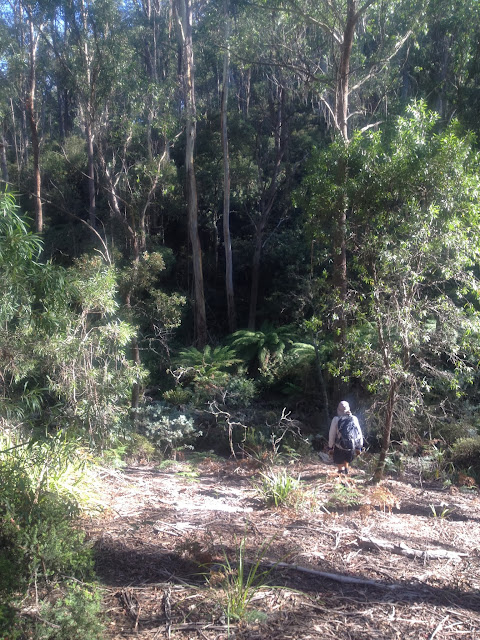
Immediately beautiful.
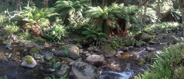
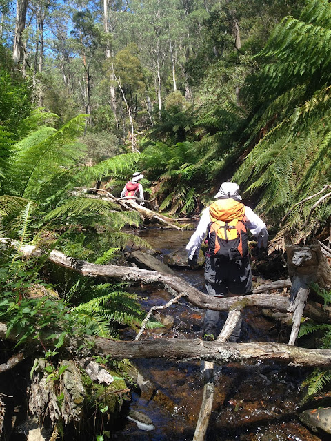
We walked a return leg of 1km in 40mins up Jerrabattgulla Creek. Linda and Eric did their usual thing.
A truly beautiful area.
Morning tea gave us the opportunity to remove leeches ... and probably pick up more.
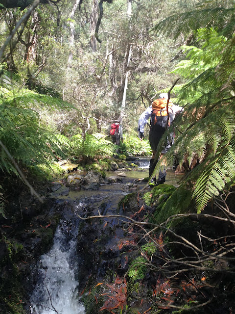
Then followed a lovely 600m walk in 30mins up an un-named tributary. We were surprised by the amount of water.
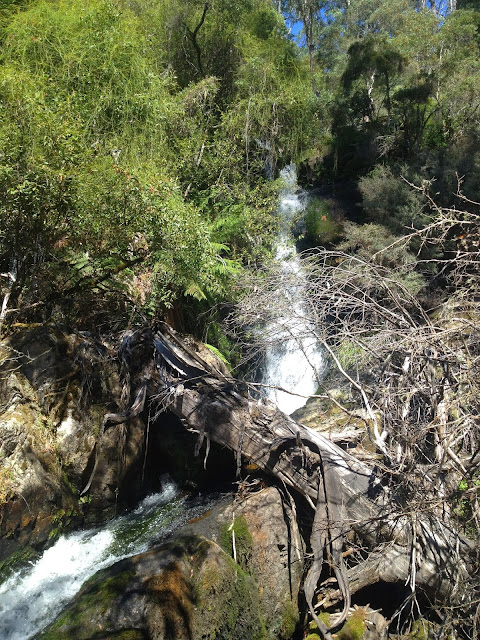
We arrived at the bottom of a waterfall which we'd seen on 5 Mar 13. Noisy and spectacular. We had a poke about, then clambered up the side to the top viewing rock.
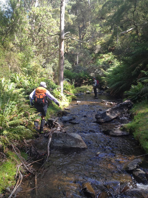
Another delightful leg up the creek, 1.4km taking 1 hour. Dianella with purple fruit everywhere.
After lunch we took another tributary (which had plenty of water flowing), following it up 0.9km in 40mins.
|